Western Brook Pond
Out East Adventures, in collaboration with BonTours, are thrilled to offer captivating hiking experiences around Western Brook Pond. Tailor your adventure with a challenging 1-day trek or enjoy a more leisurely exploration with our extended 2-day hike, giving you extra time to soak in the stunning surroundings. For the bold explorers, our rugged 4-day backpacking journey awaits, ensuring there's a perfect trail for every adventurer.

Frequently asked questions
The Trail
(1 day and 2 day options)
Distance: 18km (6km access trail + 12km Backcountry)
Difficulty: 5/5
Length: 10-12 Hours (Day hike)


Walk into the Dock
3km, 30m elevation, avg slope: 1%
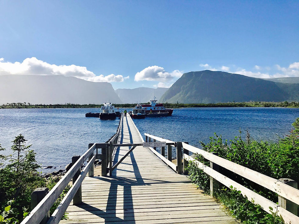
The Western Brook Pond tour begins with a 3km walk into the boat dock. This trail is a gravel road over mostly flat terrain. We make a couple stops on the way for pictures, interpretation, and this is a great chance for the group to get to know each other.
Once we arrive at the dock we take a break with the last chance to use a flushing toilet.
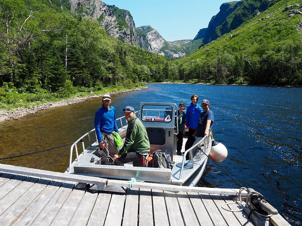
From here we take a 30 minute ride on our high speed shuttle boat into the back of the gorge.
The Western Brook Pond Gorge is best described in 3 stages, The first of which begins as soon as we get off the boat into the backcountry.
Phase One: Through the Valley
3.5km, 175m elevation, avg slope: 5%
The longest - but easiest - phase of the hike
The Landslide Bypass & Moose Meadow
This stage is relatively easy and begins with a gentle grade as we move up into the forest. Less than half a kilometre off the boat we need to bypass a landslide that happened in the winter of 2022. This section of trail is rough but is a good introduction into what the more difficult phases will be like.
We then pass through "Moose Meadow” - a giant meadow with a pond in its centre - before entering the forest again. Early in the season, or after heavy rainfall, the pond in the middle of Moose Meadow can get so large it encompasses the entire meadow and we may be forced to bushwack in very rough terrain along the steep sides of the valley for a short distance before getting back to our normal route.


Phase One: Over the Rockslide
Sometime during the winter of 2018, an avalanche and rockslide occurred which caused major changes throughout the valley, including to our trail. As we make our way uphill, we slowly emerge onto a massive rocky debris field. While this field has stabilized in that it is no longer sliding, it does present us with very unstable footing. We have
created a small path through this, and your guide will explain where to walk, and to use caution in where you step, as many of the rocks are loose. Due to some loose rocks, this section is difficult and is an opportunity for anyone who is uncomfortable with the terrain to turn back.
Phase One: Into the Forest & Through the Rivers
On descending from the rockslide back into the forest we are quickly met with the first stream crossing. Throughout this section we will be crossing back and forth across a
river bed at least a dozen times. The conditions for this section are highly dependent on recent weather. This can either mean it will be completely dry or have waist deep water running through it. Water shoes or sandals are not practical, due to the number of crossings we may need to do. If there is water in the gorge, we're going to get our feet wet, there is no avoiding it. This is part of the experience!
Phase One finishes at a natural spring which is a great opportunity to stop for a short rest and refill our water.


Phase Two: The Incline Begins
1km, 100m elevation, avg slope: 10%
The incline - and the heard rates - start to increase
As we pass the river crossings, the route begins to get steadily more and more steep while we wind our way through the forest. The terrain underfoot remains difficult, with more roots and rocks to navigate.
We finally emerge from the tree cover at the base of a waterfall where we stop for an extended break and usually have our lunch. This is a time to re-evaluate ourselves, our
energy levels and decide whether to press on. We do often get people that choose to remain at the waterfall rather than push on ahead.
There is a small perch accessible from here that gets above the treeline and does offer a similar - but not as spectacular - view of the gorge.
Phase Three: The Scramble
0.75km, 150m elevation, avg slope: 20%, max slope: 40%
Time to dig deep, get dirty, and help each other to the top
From the waterfall to the viewpoint is what we call “The Scramble”, where we will cover almost a third of the entire day’s elevation in well under a kilometer. This is by far the steepest section, however it is not a true climb as we are in the forest the entire time. There are no sheer cliffs or any special equipment needed.
With that being said, it is as steep as you can get without being a climb requiring equipment. This section can take between 20 and 40 minutes.


The View
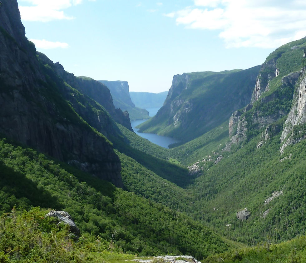
Finally we emerge onto a rocky clearing and are immediately rewarded with one of the most stunning views you can find on the east coast of North America.
The valley of Western Brook Pond opens up below you. The winding fjord and its steep cliffs provide the backdrop as life seems to stand still for a moment. You've earned this.
Here we catch our breath and settle in for lunch. We aim to spend 45 minutes at the viewpoint, so we have lots of time for photos and a chance to take in the moment.
Keep in mind we are only half-way finished with the hike.
Returning Home
This part of the hike is often overlooked, but it is one of the most important parts.
Reaching the viewpoint is only the halfway point, we still need to go back the way we came. This means we need to keep our energy levels up.
Eating a decent lunch, snacking along the way and drinking plenty of water are all vital parts of this hike.
We have had clients that have metaphorically crashed on the way back down due to a lack of energy. Most people will burn an additional 2000 - 3000 calories during a day of
heavy exercise, and that energy needs to come from somewhere.
We aim to be back to the parking lot by around 6:00PM (for the 7AM tour), 7:00PM (8AM tour) or 8:00PM (9AM tour), however this can vary based on the speed of the
group and the conditions for that day. Please keep this in mind, especially if making dinner reservations, or if you have a long drive.


